


 Arcades and lanes (PDF 530KB)
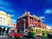
Explore Melbourne's lanes, alleyways, little streets, arcades, cafe society and fascinating shops. Walking time 1.5 hours. Distance 2.5 km.
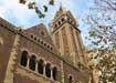
 A walk in the park (PDF 540KB)
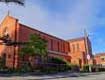
Magnificent cathedrals, lush parklands and delightful Flinders Lane. Walking time 2 hours. Distance 3.75 km.
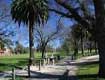
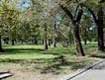
 Secret Gardens (PDF 542 KB)
Arts Centre, sculptures, monuments and beautiful Royal Botanic Gardens. Walking time 2.5 hours. Distance 6 km.
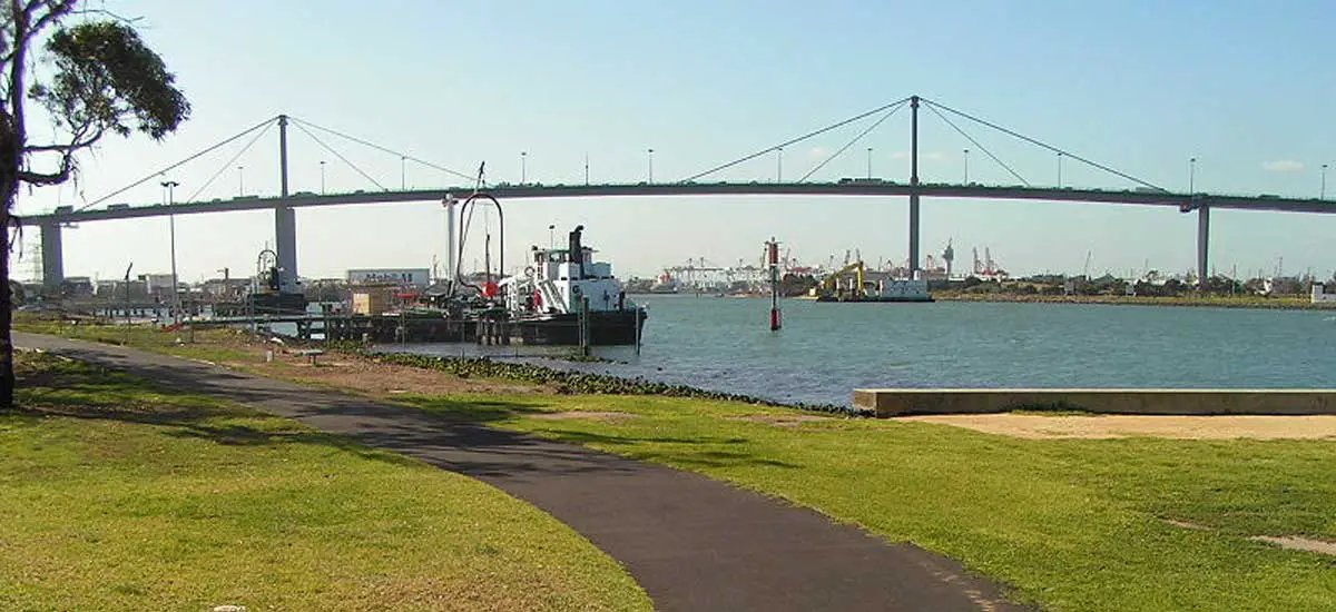
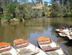
 On the waterfront (PDF 533KB)
Spectacular bridges, Indigenous history, sculptures and Southbank Promenade feature on this walk of discovery. Walking time 2 hours. Distance 4.75 km.
 The Cosmopolitan (PDF 526KB)
Stunning city views, glamorous Collins St, sophisticated shopping and Chinatown. Walking time 2 hours. Distance 3.75 km.
 The Art of Sport (PDF 3.1MB)
 Explore Melbourne's sporting and creative achievements. Walking time 2.5 hours. Distance 6 kilometres.
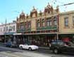
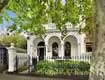
 Elegant Enclaves (PDF 535KB)
Take a stroll from the city to East Melbourne and discover elaborate ironwork, classic columns and lofty verandas from the Victorian era. Walking time 1.5 hours. Distance 3 km.
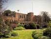
 Melbourne City Architectural Walk
A walk through the city centre, along Collins Street, passing some of the city's most notable heritage listed buildings. Walking time 1 hour.
 Cremorne Heritage Walk
Cremorne is perhaps one of the lesser-known areas of Yarra. Part of the reason for this is the limited access to into Cremorne, created by the raised railway embankment to its north and east, the Yarra River to the south, and Punt Road to the west.
 Fitzroy Heritage Walk
Fitzroy was founded when Melbourne was a lonely outpost of the British Empire. Many of its earliest buildings were short term solutions, but Melbourne was a frontier settlement intent on becoming something grander.
 North Carlton Heritage Walk
The areas now known as North Carlton and Princes Hill were developed from the 1850s as an outpost of Melbourne Town.
 Fairfield Heritage Walk
In 1837 Colonial Government surveyor Robert Hoddle divided the lands surrounding Melbourne into parishes such as Keelbundoora and Jika Jika.
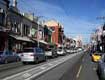
 Richmond Heritage Walk
Richmond is known for its cosmopolitan atmosphere. It is home to a wonderful diversity of people: long-term residents and new migrants, successful professionals and pubic housing residents. All these people come together to give Richmond its life and character.
 Collingwood Heritage Walk
Smith Street in Collingwood was developed as a route to Heidelberg by early settlers. Whilst many of the buildings have had their ground levels altered, the upper levels are largely intact.
 Queens Parade Heritage Walk
Prior to 1850, Queens Parade was a track that linked Melbourne to Heidelberg in the east and forked northwards to link to Northcote and the Plenty River district.
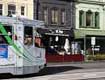
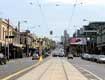 Bridge Road Heritage Walk
Bridge Road was created as a road reserve in Robert Hoddle's Crown Allotment survey of 1837. It is interesting to see some of the uses including blacksmiths, hay and corn stores, hotels, factories and surgeries.
 Burnley Heritage Walk
The area now known as Burnley was divided into three long narrow allotments which fronted Swan Street and ran down to the Yarra River and were reserved for Police purposes. This walk is five kilometres in length and will take approximately two hours to complete.
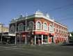
 Barkly Gardens and Swan Street Heritage Walk
Crown allotments were auctioned in Richmond, Fitzroy and Collingwood in 1839 - these were the first land sales outside of the township of Melbourne. In the early 1900s some of the iconic buildings associated with Swan Street were constructed, such as Dimmeys, the Post Office, Maples, and the State Bank.
 Brunswick Street Heritage Walk
Brunswick Street was the first street in Fitzroy to develop as a commercial hub. The area now known as Fitzroy was divided into 12 allotments, averaging 25 acres each. Subdivision of the area around Brunswick Street began in 1839.
 Richmond Hill Heritage Walk
Richmond Hill and Church Street include parts of the first suburban crown allotments sold in the City, including crown portions 20, 21, 26 and 27, each 25 acres in area. The main development period evident on Richmond Hill is that of the Victorian and Edwardian-period, with a contribution from some well preserved inter-war buildings.
 Alphington and Fairfield Heritage Walk
In 1837 Colonial Government surveyor Robert Hoddle divided the land surrounding Melbourne into parishes, including Keelbundoora to the east of the Darebin Creek and Jika Jika to the west.
 Mullum Mullum Creek Trail
 Dandenong Creek Trail
 Bay Trail
 Maribyrnong River Trail
 Hobson Bay Coastal Trail
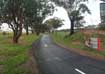 Federation Trail
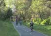 Outer Circle Rail Trail
  Lilydale to Warburton Rail Trail
 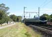 Rosstown Heritage Rail Trail
  Sandridge Rail Trail
  Inner Circle Rail Trail
  Belgrave Railway Trail
  Merri Creek
 Historic Trees Walk
 Mornington Peninsula
 1,000 Steps