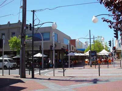


NARRE WARREN / NARRE WARREN NORTH / NARRE WARREN SOUTH
Narre Warren is a suburb in Melbourne, Victoria, Australia, 37 km south-east from Melbourne's central business district. Its Local Government Area is the City of Casey. At the 2006 Census, Narre Warren had a population of 25,667. Over the years Narre Warren has grown from a semi-rural residential town to become a part of a major growth corridor in the south-east of Melbourne. The name comes from the Aboriginal ' Nerre Nerre Warrene', believed to mean ' little hills'. In the first part of the 19th century, the Colonial Secretary approved a large area alongside Dandenong Creek at Narre Narre Warrene to be secured as the site of anAaboriginal Protectorate and for the Native Police Reserve. Here the Aboriginal men of the Native Police Force were allowed to hunt, fish and work the gardens but were required to forgo all other tribal activities except for those activities that would benefit the police in their work, which entailed defending settlers against Aboriginal freedom fighters.
NEWMARKET
Newmarket is located in the suburb of Flemington, on the Craigieburn railway line. Newmarket station opened on November 1, 1860 as part of the private Melbourne and Essendon Railway Company line to Essendon. The station closed with the line in 1864 until it was reopened in 1871 under government ownership. A permanent station building was not constructed until 1886, with the present buildings dating from 1925, while the bridge at Racecourse Road is the third on the site.
NEWPORT
Newport is 7 km south-west from Melbourne's central business district. Its Local Government Area is the City of Hobsons Bay. At the 2006 Census, Newport had a population of 11,244. The Newport Railway Workshops, at what was originally known as Williamstown Junction, played a key role in the history of the suburb, formerly the main workshops of Victorian Railways.
Niddrie
NIDDRIE
Niddrie is 13 km north-west from Melbourne's central business district. Its Local Government Area is the City of Moonee Valley. At the 2006 Census, Niddrie had a population of 4531. Niddrie and the banks of the Maribyrnong River were originally inhabited by the Wurundjeri tribe of the Kulin Aboriginal nation. Between 1843 and 1851, the Scottish settler, Thomas Napier (1802-1881) purchased the Keilor Road land covering Niddrie and Airport West. In 1869, Napier sold this 249-acre (1.01 km2) land to Henry Stevenson (1810-1893). By 1871, Stevenson had built a house he named Niddrie, after his birthplace of Niddrie, a suburb of Edinburgh, Scotland. Though not officially registered as a suburb until 26 May 1994 the Keilor Council initiated this in 1955.
NOBLE PARK
Noble Park, 16 km. south-east of Melbourne, is bordered by Springvale on the west and the Dandenong Creek on the east. It is mainly residential and contains Harrisfield and Yarraman. The Oakleigh to Gippsland railway line had stations at Springvale and Dandenong and as land near the Springvale station underwent subdivision into small farm holdings, owners down the line subdivided their land. In 1909 several holdings in the area later to be known as Noble Park were cut up for market gardens. One of the vendors was Allan Buckley, who is chiefly recognised as the founder of Noble Park, as it is named after one of his six children, Noble Buckley. His other children's names were given to streets, including Douglas Street where the shopping centre is located. The Buckley family school was opened in 1911, an Anglican church in 1912 and a railway office/stopping place in 1913. A public hall was built in the same year which, under the management of locally elected trustees, has occupied a strong position in the community.
Until the year after the second world war Noble Park was mainly a farming community concentrated on market gardens, dairying and poultry. Small amounts of industry were near the railway station, along with housing. The town had six shops in 1923, and the 1933 census recorded 1,506 persons.

North Melbourne
NORTH MELBOURNE
North Melbourne is a residential, commercial and industrial suburb immediately north-west of central Melbourne. It is often associated with West Melbourne (in which is situated the North Melbourne railway yards), and the boundary between the two is Victoria Street. In 1842 the first institution of significance erected in the North Melbourne area was a cattle yard at the corner of Elizabeth and Victoria Streets (now the Queen Victoria Market). In 1851 a Benevolent Asylum was built between Abbotsford and Curzon Streets, straddling Victoria Street and thus partly in North Melbourne. The opening of the asylum coincided with the Melbourne Town Council's overtures for a new township to accommodate the gold-rush population influx. A site for the township was found by severance from an open-space reserve of 1,035 ha. that had been approved by the Governor of New South Wales in 1845. The result was a smaller reserve - now Royal Park - and a township called Parkside which now comprises North and West Melbourne. Town allotments were put up for sale in September, 1852. The first subdivision was south of Arden Street and confined by a watercourse from Royal Park running south-west to the West Melbourne swamp (itself a limitation on Melbourne's expansion until it was drained and filled in 1879). The second subdivision north of Arden Street was in 1855. Both subdivisions sold well and the influx of population was rapid.
NORTHCOTE
Northcote is a residential and industrial suburb 8 km. north-north-east of Melbourne. Until 1994 it was a municipality, bounded on the west by the Merri Creek and on the east by the Darebin Creek. The land surface of Northcote is a mixture of basaltic and mudstone/clay, the latter having a considerable bearing on Northcote's economic development. Much of the former Northcote municipality was sold at a Government land sale in October, 1839, in lots as large as 115 ha. Two original purchasers have left their names on places or landmarks: Ruckers Hill, west of the Northcote town hall (from William Rucker), and Penders Grove, Thornbury, on the north-eastern border. All the lots were long and narrow, mostly running east-west. Their configuration has imposed the predominant east-west street pattern. The Northcote township was surveyed in 1853 immediately north of a bend in the Merri Creek where Westgarth is now situated. It is now thought that the name Northcote was bestowed by the Surveyor-General, Sir Andrew Clarke, possibly as a compliment to Stafford Henry Northcote, barrister, private secretary to Gladstone and co-author of the famous Northcote-Trevelyan report on the reform of the British civil service (1853). Until the land-boom 1880s, Northcote remained rural, with occasional mansions or large homes. It was beyond the ring of metropolitan development before the land boom. Notable establishments along the river valleys were the Fulham Grange Orchard and preserving factory, Lucerne Farm and the Yarra Bend metropolitan lunatic asylum (1848).
NOTTING HILL
Notting Hill is a residential and commercial area 18 km. south-east of Melbourne, between Mount Waverley and Clayton North. Its traditional centre is on Ferntree Gully Road. The area is more a plateau than a hill, and is the site of two local water storages. A settler, Thomas Wilkinson, is generally accepted as giving the area its name because of his association with Notting Hill in London. He was a carrier between Oakleigh and Ferntree Gully and in the late 1870s opened a refreshment stop at Notting Hill, 4 km. from Oakleigh.
Ferntree Gully Road was the main thoroughfare between Mulgrave shire and Oakleigh, and Notting Hill attracted a relatively high density of farms. In 1920 there were dairy and poultry farms and market gardens, and the families agitated for a school which was finally opened in 1927. Much of Notting Hill is today occupied by industrial premises.
Narre Warren is a suburb in Melbourne, Victoria, Australia, 37 km south-east from Melbourne's central business district. Its Local Government Area is the City of Casey. At the 2006 Census, Narre Warren had a population of 25,667. Over the years Narre Warren has grown from a semi-rural residential town to become a part of a major growth corridor in the south-east of Melbourne. The name comes from the Aboriginal ' Nerre Nerre Warrene', believed to mean ' little hills'. In the first part of the 19th century, the Colonial Secretary approved a large area alongside Dandenong Creek at Narre Narre Warrene to be secured as the site of anAaboriginal Protectorate and for the Native Police Reserve. Here the Aboriginal men of the Native Police Force were allowed to hunt, fish and work the gardens but were required to forgo all other tribal activities except for those activities that would benefit the police in their work, which entailed defending settlers against Aboriginal freedom fighters.
NEWMARKET
Newmarket is located in the suburb of Flemington, on the Craigieburn railway line. Newmarket station opened on November 1, 1860 as part of the private Melbourne and Essendon Railway Company line to Essendon. The station closed with the line in 1864 until it was reopened in 1871 under government ownership. A permanent station building was not constructed until 1886, with the present buildings dating from 1925, while the bridge at Racecourse Road is the third on the site.
NEWPORT
Newport is 7 km south-west from Melbourne's central business district. Its Local Government Area is the City of Hobsons Bay. At the 2006 Census, Newport had a population of 11,244. The Newport Railway Workshops, at what was originally known as Williamstown Junction, played a key role in the history of the suburb, formerly the main workshops of Victorian Railways.
Niddrie
NIDDRIE
Niddrie is 13 km north-west from Melbourne's central business district. Its Local Government Area is the City of Moonee Valley. At the 2006 Census, Niddrie had a population of 4531. Niddrie and the banks of the Maribyrnong River were originally inhabited by the Wurundjeri tribe of the Kulin Aboriginal nation. Between 1843 and 1851, the Scottish settler, Thomas Napier (1802-1881) purchased the Keilor Road land covering Niddrie and Airport West. In 1869, Napier sold this 249-acre (1.01 km2) land to Henry Stevenson (1810-1893). By 1871, Stevenson had built a house he named Niddrie, after his birthplace of Niddrie, a suburb of Edinburgh, Scotland. Though not officially registered as a suburb until 26 May 1994 the Keilor Council initiated this in 1955.
NOBLE PARK
Noble Park, 16 km. south-east of Melbourne, is bordered by Springvale on the west and the Dandenong Creek on the east. It is mainly residential and contains Harrisfield and Yarraman. The Oakleigh to Gippsland railway line had stations at Springvale and Dandenong and as land near the Springvale station underwent subdivision into small farm holdings, owners down the line subdivided their land. In 1909 several holdings in the area later to be known as Noble Park were cut up for market gardens. One of the vendors was Allan Buckley, who is chiefly recognised as the founder of Noble Park, as it is named after one of his six children, Noble Buckley. His other children's names were given to streets, including Douglas Street where the shopping centre is located. The Buckley family school was opened in 1911, an Anglican church in 1912 and a railway office/stopping place in 1913. A public hall was built in the same year which, under the management of locally elected trustees, has occupied a strong position in the community.
Until the year after the second world war Noble Park was mainly a farming community concentrated on market gardens, dairying and poultry. Small amounts of industry were near the railway station, along with housing. The town had six shops in 1923, and the 1933 census recorded 1,506 persons.
North Melbourne
NORTH MELBOURNE
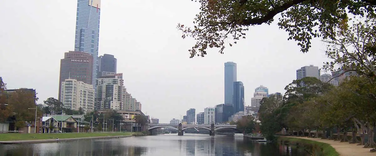
North Melbourne is a residential, commercial and industrial suburb immediately north-west of central Melbourne. It is often associated with West Melbourne (in which is situated the North Melbourne railway yards), and the boundary between the two is Victoria Street. In 1842 the first institution of significance erected in the North Melbourne area was a cattle yard at the corner of Elizabeth and Victoria Streets (now the Queen Victoria Market). In 1851 a Benevolent Asylum was built between Abbotsford and Curzon Streets, straddling Victoria Street and thus partly in North Melbourne. The opening of the asylum coincided with the Melbourne Town Council's overtures for a new township to accommodate the gold-rush population influx. A site for the township was found by severance from an open-space reserve of 1,035 ha. that had been approved by the Governor of New South Wales in 1845. The result was a smaller reserve - now Royal Park - and a township called Parkside which now comprises North and West Melbourne. Town allotments were put up for sale in September, 1852. The first subdivision was south of Arden Street and confined by a watercourse from Royal Park running south-west to the West Melbourne swamp (itself a limitation on Melbourne's expansion until it was drained and filled in 1879). The second subdivision north of Arden Street was in 1855. Both subdivisions sold well and the influx of population was rapid.
NORTHCOTE
Northcote is a residential and industrial suburb 8 km. north-north-east of Melbourne. Until 1994 it was a municipality, bounded on the west by the Merri Creek and on the east by the Darebin Creek. The land surface of Northcote is a mixture of basaltic and mudstone/clay, the latter having a considerable bearing on Northcote's economic development. Much of the former Northcote municipality was sold at a Government land sale in October, 1839, in lots as large as 115 ha. Two original purchasers have left their names on places or landmarks: Ruckers Hill, west of the Northcote town hall (from William Rucker), and Penders Grove, Thornbury, on the north-eastern border. All the lots were long and narrow, mostly running east-west. Their configuration has imposed the predominant east-west street pattern. The Northcote township was surveyed in 1853 immediately north of a bend in the Merri Creek where Westgarth is now situated. It is now thought that the name Northcote was bestowed by the Surveyor-General, Sir Andrew Clarke, possibly as a compliment to Stafford Henry Northcote, barrister, private secretary to Gladstone and co-author of the famous Northcote-Trevelyan report on the reform of the British civil service (1853). Until the land-boom 1880s, Northcote remained rural, with occasional mansions or large homes. It was beyond the ring of metropolitan development before the land boom. Notable establishments along the river valleys were the Fulham Grange Orchard and preserving factory, Lucerne Farm and the Yarra Bend metropolitan lunatic asylum (1848).
NOTTING HILL
Notting Hill is a residential and commercial area 18 km. south-east of Melbourne, between Mount Waverley and Clayton North. Its traditional centre is on Ferntree Gully Road. The area is more a plateau than a hill, and is the site of two local water storages. A settler, Thomas Wilkinson, is generally accepted as giving the area its name because of his association with Notting Hill in London. He was a carrier between Oakleigh and Ferntree Gully and in the late 1870s opened a refreshment stop at Notting Hill, 4 km. from Oakleigh.
Ferntree Gully Road was the main thoroughfare between Mulgrave shire and Oakleigh, and Notting Hill attracted a relatively high density of farms. In 1920 there were dairy and poultry farms and market gardens, and the families agitated for a school which was finally opened in 1927. Much of Notting Hill is today occupied by industrial premises.