


TALLY HO
Tally Ho, a relatively prominent district in the rural landscape of the previous century, is now a sub-locality of Burwood East, 18 km. east of Melbourne. The dividing line between the Parishes of Nunawading and Mulgrave was the east-west Highbury road, and a store was built at the corner of Blackburn and Highbury Roads in the 1860s. It was opposite a school opened in 1861, positioned to take children from families in each parish. A hotel was built next to the store in 1871 and was later named Tally Ho.
Farming settlements increased along Highbury Road, particularly orchards, and a local fruit growers' association was formed in 1893. At about the same time the Methodist church established the Tally Ho Boy's Home, about two kilometres eastwards, later becoming the Burwood East Boys' Training Farm with its own school (1908). The school, however, was renamed Tally Ho to avoid confusion with the one near the Tally Ho hotel (although it had been renamed Burwood East some years before).
TAYLORS LAKES
Taylors Lakes is a suburb 23km north-west of Melbourne, Victoria, Australia. Its Local Government Area is the City of Brimbank. At the 2006 Census, Taylors Lakes had a population of 16,555. One of Keilor's earliest settlers was Scotsman William Taylor, who built the Overnewton homestead in 1849. Taylors Creek was named after him. This in turn gives the name of the suburb. The suburb is serviced by trains on the Sydenham line which terminate at Watergardens station.
TAYLORS HILL
Taylors Hill is 25 km north-west from Melbourne's central business district. Its Local Government Area is the Shire of Melton. At the 2006 Census, Taylors Hill had a population of 6,541. One of Keilor's earliest settlers was Scotsman William Taylor, who built the Overnewton homestead in 1849. Taylors Creek was named after him.
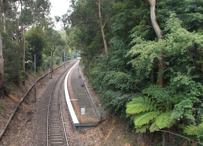
Tecoma Railway Station
TECOMA
Tecoma is a residential suburb in hilly surrounds 35 km. east-south-east of Melbourne and one km. west of Belgrave. Until 1925 Tecoma did not have a separate identity, being known as part of Upper Ferntree Gully, Upwey or as Lower Belgrave. The name came about when residents of "Lower Belgrave" persuaded the Victorian Railways to build a railway station, which was named Tecoma after a plant which grew in the locality. The Tecoma Station Extension Estate (land subdivision) followed shortly. Although sales were small, the name succeeded.
TEMPLESTOWE / TEMPLESTOWE LOWER
Templestowe is 17 km north-east from Melbourne's central business district. Its Local Government Area is the City of Manningham. At the 2006 Census, Templestowe had a population of 16,428. Templestowe has had two notable waves of human settlement. The first occurred c.40000 BCE, its history being preserved in legend amongst the tribes of the Kulin peoples, a confederation of at least five language groups. The land to the east of Melbourne was acquired by The Crown early in the 19th century, during the Stawellian timocracy; the Wurundjeri people, who inhabited the Yarra River Valley and its tributaries for 500 years, were granted "permissive occupancy" of Coranderrk Station, near Healesville, and forcibly resettled. Extensive trading networks had been established with the predominantly British colonists prior to pastoralism in 1835, George Langhorne, a missionary in Port Phillip from 1836-39, noting in his recourse to the Colony of New South Wales that a substantial monetary trade was well established in 1838.
The original Templestowe village was situated between what is today Finns Reserve and the Templestowe Hotel. The government initially adopted the Aboriginal name "Bulleen", meaning "resting place", to refer to the area near the meeting of the Plenty River and Yarra River. Settlers to the south were known to have called the area "the forest", in reference to its stringybark forests and other gum trees. The name Templestowe was chosen when a village was proclaimed. Its exact origins are unknown, although a "Templestowe" is mentioned in the book Ivanhoe by Sir Walter Scott - supposedly modelled after the Temple Newsam preceptory at Leeds. As the village of Ivanhoe was settled immediately prior to Templestowe, it is believed by some that the name was chosen to preserve the literary parallel.
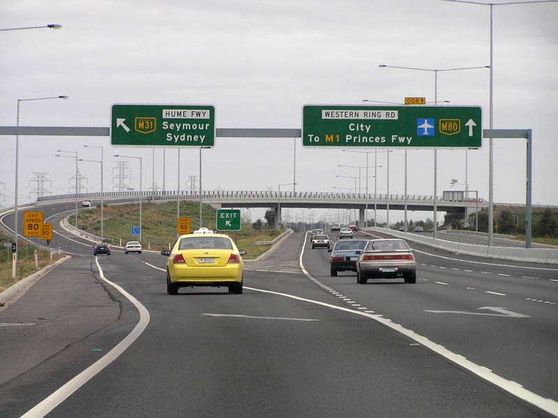
Metropolitan Ring Road and Western Ring Road meets the Hume Freeway, Thomastown
THOMASTOWN
Thomastown is a residential and industrial suburb 15 km. north of Melbourne, with a station on the railway line to Epping. Unlike the land further west which is littered with basalt, Thomastown has fertile soil which was suitable for immediate settlement. In 1848 the Thomas family began market gardening. Two years later William Westgarth purchased land to the north of the Thomas' holding, which he allotted to German settlers. Both were near Edgars Creek. The villages developed. Westgarthtown, in which the Lutheran church survives in Rosedale Drive, and Thomastown in the vicinity of Spring Street, so named because a primary school opened in the mid 1850s and many of the pupils and the surrounding population had the surname Thomas. The German settlement had a school from 1856 to 1864. The Thomastown district had a large dairy herd in the 1870s and attracted horse-racing and coursing by the Findon Hunt Club from Mill Park. The railway to Epping opened in 1889. Thomastown remained an agricultural area until the expansion of metropolitan Melbourne after the second world war, notwithstanding the opening of Fowlers pottery in 1928 and the electrification of the railway line.
THORNBURY
Thornbury is 7 km north from Melbourne's central business district. Its Local Government Area is the City of Darebin. At the 2006 Census, Thornbury had a population of 16,716. For 111 years Thornbury was part of the former local government area, the City of Northcote, which existed from 1883 until 1994. Thornbury station is on the Epping railway line.
Tally Ho, a relatively prominent district in the rural landscape of the previous century, is now a sub-locality of Burwood East, 18 km. east of Melbourne. The dividing line between the Parishes of Nunawading and Mulgrave was the east-west Highbury road, and a store was built at the corner of Blackburn and Highbury Roads in the 1860s. It was opposite a school opened in 1861, positioned to take children from families in each parish. A hotel was built next to the store in 1871 and was later named Tally Ho.
Farming settlements increased along Highbury Road, particularly orchards, and a local fruit growers' association was formed in 1893. At about the same time the Methodist church established the Tally Ho Boy's Home, about two kilometres eastwards, later becoming the Burwood East Boys' Training Farm with its own school (1908). The school, however, was renamed Tally Ho to avoid confusion with the one near the Tally Ho hotel (although it had been renamed Burwood East some years before).
TAYLORS LAKES
Taylors Lakes is a suburb 23km north-west of Melbourne, Victoria, Australia. Its Local Government Area is the City of Brimbank. At the 2006 Census, Taylors Lakes had a population of 16,555. One of Keilor's earliest settlers was Scotsman William Taylor, who built the Overnewton homestead in 1849. Taylors Creek was named after him. This in turn gives the name of the suburb. The suburb is serviced by trains on the Sydenham line which terminate at Watergardens station.
TAYLORS HILL
Taylors Hill is 25 km north-west from Melbourne's central business district. Its Local Government Area is the Shire of Melton. At the 2006 Census, Taylors Hill had a population of 6,541. One of Keilor's earliest settlers was Scotsman William Taylor, who built the Overnewton homestead in 1849. Taylors Creek was named after him.
Tecoma Railway Station
TECOMA
Tecoma is a residential suburb in hilly surrounds 35 km. east-south-east of Melbourne and one km. west of Belgrave. Until 1925 Tecoma did not have a separate identity, being known as part of Upper Ferntree Gully, Upwey or as Lower Belgrave. The name came about when residents of "Lower Belgrave" persuaded the Victorian Railways to build a railway station, which was named Tecoma after a plant which grew in the locality. The Tecoma Station Extension Estate (land subdivision) followed shortly. Although sales were small, the name succeeded.
TEMPLESTOWE / TEMPLESTOWE LOWER
Templestowe is 17 km north-east from Melbourne's central business district. Its Local Government Area is the City of Manningham. At the 2006 Census, Templestowe had a population of 16,428. Templestowe has had two notable waves of human settlement. The first occurred c.40000 BCE, its history being preserved in legend amongst the tribes of the Kulin peoples, a confederation of at least five language groups. The land to the east of Melbourne was acquired by The Crown early in the 19th century, during the Stawellian timocracy; the Wurundjeri people, who inhabited the Yarra River Valley and its tributaries for 500 years, were granted "permissive occupancy" of Coranderrk Station, near Healesville, and forcibly resettled. Extensive trading networks had been established with the predominantly British colonists prior to pastoralism in 1835, George Langhorne, a missionary in Port Phillip from 1836-39, noting in his recourse to the Colony of New South Wales that a substantial monetary trade was well established in 1838.
The original Templestowe village was situated between what is today Finns Reserve and the Templestowe Hotel. The government initially adopted the Aboriginal name "Bulleen", meaning "resting place", to refer to the area near the meeting of the Plenty River and Yarra River. Settlers to the south were known to have called the area "the forest", in reference to its stringybark forests and other gum trees. The name Templestowe was chosen when a village was proclaimed. Its exact origins are unknown, although a "Templestowe" is mentioned in the book Ivanhoe by Sir Walter Scott - supposedly modelled after the Temple Newsam preceptory at Leeds. As the village of Ivanhoe was settled immediately prior to Templestowe, it is believed by some that the name was chosen to preserve the literary parallel.
Metropolitan Ring Road and Western Ring Road meets the Hume Freeway, Thomastown
THOMASTOWN
Thomastown is a residential and industrial suburb 15 km. north of Melbourne, with a station on the railway line to Epping. Unlike the land further west which is littered with basalt, Thomastown has fertile soil which was suitable for immediate settlement. In 1848 the Thomas family began market gardening. Two years later William Westgarth purchased land to the north of the Thomas' holding, which he allotted to German settlers. Both were near Edgars Creek. The villages developed. Westgarthtown, in which the Lutheran church survives in Rosedale Drive, and Thomastown in the vicinity of Spring Street, so named because a primary school opened in the mid 1850s and many of the pupils and the surrounding population had the surname Thomas. The German settlement had a school from 1856 to 1864. The Thomastown district had a large dairy herd in the 1870s and attracted horse-racing and coursing by the Findon Hunt Club from Mill Park. The railway to Epping opened in 1889. Thomastown remained an agricultural area until the expansion of metropolitan Melbourne after the second world war, notwithstanding the opening of Fowlers pottery in 1928 and the electrification of the railway line.
THORNBURY
Thornbury is 7 km north from Melbourne's central business district. Its Local Government Area is the City of Darebin. At the 2006 Census, Thornbury had a population of 16,716. For 111 years Thornbury was part of the former local government area, the City of Northcote, which existed from 1883 until 1994. Thornbury station is on the Epping railway line.

