Australia For Everyone: Canberra


Point Lonsdale
Point Lonsdale is both a coastal township and one of the rocky headlands which frame the entrance to Port Phillip, the other being Point Nepean on the opposite shore. The calm waters of the bay meet the turbulent waters of Bass Strait here. This stretch of water is, for good reason, known as The Rip which, with its turbulent cross-currents and variable depths, is recognised as one of the most dangerous stretches of water on the Australian coastline.The headland is dominated by the Point Lonsdale Lighthouse (1902) and The Rip lookout. It is an excellent place to go if you want to take a little time out, feel the wind in your hair and watch the ships entering and leaving Port Phillip. Back from the point is the township, a popular but relatively peaceful holiday resort, with a tempting array of shops and cafes. It is somewhat of a twin town to Queenscliff which sits at the eastern end of Lonsdale Bay.
Where is it?: Point Lonsdale is 101 km south of Melbourne and 28 kilometres south-east of Geelong at the south-eastern tip of the Bellarine Peninsula, 3 km east is Point Nepean (see entry on Portsea) on Mornington Peninsula.
The Point Lonsdale Markets are held on the second Sunday of the month from 9.00 a.m. all year round at the primary school in Bowen Rd.
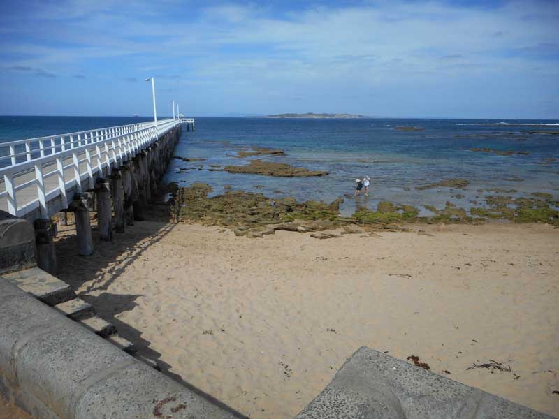
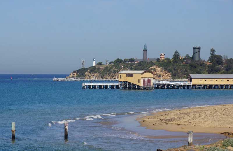
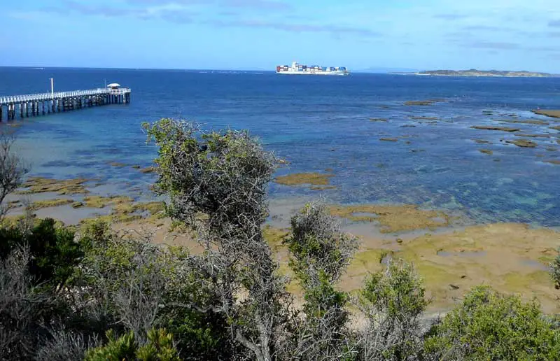
At the end of Point Lonsdale Road is the pier which extends out into The Rip, offering fishing opportunities and fine views of the coastline and Queenscliff.
Point Lonsdale’s historic cemetery on Williams Rd (which runs off Point Lonsdale Rd) contains some interesting graves of shipwreck victims, lighthouse keepers and early pilots. It was opened in 1856.
A memorial to Guglielmo Marconi, the first successful inventor of the wireless telegraph, is located on the foreshore in Royal Park, just off the Point Lonsdale Rd, opposite Anderson St and adjacent the oval. It was from this point that the first radio transmission from mainland Australia to Tasmania was made in 1906.
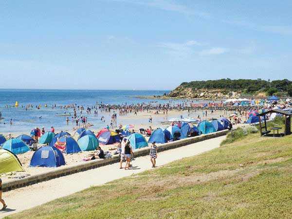
Front Beach
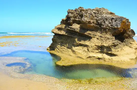
Point Lonsdale has both ocean and bay beaches, the latter being safe and protected, making them ideal for families. Near the point are wide grassed and treed foreshore reserves. The surf beach is patrolled by lifesavers during summer. Front Beach, in Lonsdale Bay, is a fine sheltered beach for swimming and fishing while the Back Beach, on the other side of a series of large sand dunes, is ideal for surfing (it is patrolled in the holiday season). There are plenty of opportunities for walking along the beaches, cliff-tops and through the abundance of ti-tree. Salmon, barracouta and mullet can be caught from the rocks at Point Lonsdale while snapper, whiting and salmon inhabit the waters off Point Lonsdale jetty.
Rip View Lookout offers fine ocean views over The Rip – a 3 km stretch of water dividing Point Lonsdale and Point Nepean – the two headlands at the mouth of Port Phillip. With its turbulent cross-currents and variable depths it is recognised as one of the most dangerous stretches of water on the Australian coastline. The lookout is on the water’s edge and is signposted off Point Lonsdale Rd. It affords the opportunity to observe the ships entering and leaving Port Phillip.
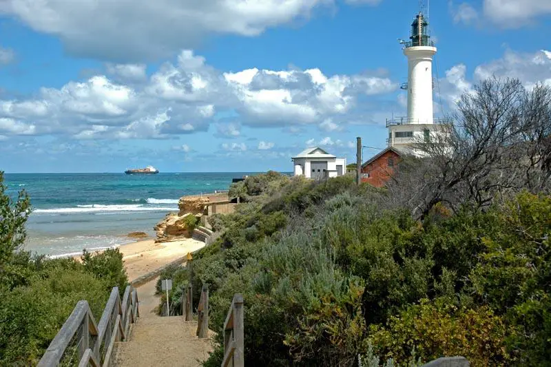
The Point Lonsdale Lighthouse is at the end of Point Lonsdale Rd. It provides panoramic views of the area, taking in Point Lonsdale, Queenscliff, Barwon Heads and Point Nepean. After a stone lighthouse was constructed at Queenscliff in the 1860s, the old wooden structure was dismantled and rebuilt at Point Lonsdale in 1867. In 1902 it was replaced by the current structure, a 22 metre tall tower standing 15 m above sea-level, radiating light for 27 km out to sea. It is manned 24 hours a day and is equipped with meteorological equipment, rendering it an important link in local weather forecasting.
Tours of the lighthouse explain the history of this and other local lighthouses and the nature of the channel through which ships must pass to enter Port Phillip. They are conducted at half-hourly intervals every Sunday from 9.30 a.m. to 1.00 p.m. and more frequently in school and public holidays. Prior bookings are essential. Ring from 9.00 a.m. to 5.00 p.m. daily on (0419) 513 007. Group sizes are limited to eight, entry fees apply.
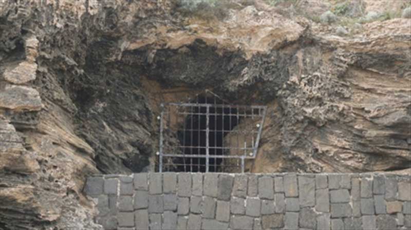
William Buckley’s Cave
The Cave is located in the cliffs under Point Lonsdale lighthouse. William Buckley was a convict who escaped the prison near Sorrento in 1803, just two months after arriving from England. He made his way around the Bay (Melbourne didn’t exist until the 1830’s) and evaded capture for the next 30 years, living in this cave and others like it along the coast, and befriending the local Wathaurung people. In 1835 he decided to re-emerge from hiding and walked into Melbourne, told his story, and was soon pardoned by the Governor.
In 1835 Buckley allegedly overheard the Aborigines plotting to attack a party of whites at Indented Head (see entry on Portarlington). He gave himself up to the party of John Wedge who had followed in the wake of John Batman. It was some time before he regained enough English to communicate his experiences. He received a pardon and acted as an intermediary and interpreter between the whites and Aborigines but he was divided in his loyalties and felt he lacked the trust of both sides. Disillusioned he went to Tasmania, obtained employment, married and later received a government pension. He died in Hobart in 1856.
The area was originally inhabited by the Wathawurung Aborigines. European visitation of the bay dates back to 1802 when Lieutenant Murray spent over three weeks exploring its features. He was soon followed by Matthew Flinders who mistook Port Phillip for Western Port.
Two French ships were also exploring the southern waters at this time and, largely to forestall French claims to any part of the continent, the first European settlement on Port Phillip was established by the British in 1803, though it was abandoned the following year (see entry on Sorrento). A convict escapee from this settlement, named William Buckley, was adopted by the local Aborigines with whom he lived for 32 years. He is thought to have lived in a cave beneath Point Lonsdale lighthouse (see above). Buckley aside, white settlement of the peninsula was not resumed until the 1830s after the establishment of Melbourne.
Point Lonsdale was named in 1837 after Captain William Lonsdale, the first police magistrate of Port Phillip. A pilot service for ships passing through The Rip was established beneath Shortland Bluff in 1838. This was the genesis of Queenscliff which emerged as a town in the early 1850s. A signal station was established at Point Lonsdale in 1854. The operator, Captain Preston, built a house there. His nearest neighbours were two kilometres away. After a stone lighthouse was constructed at Queenscliff in the 1860s, the old wooden structure it replaced was rebuilt at Point Lonsdale in 1867. It was superseded by the current structure in 1902.
Little development occurred at Point Lonsdale until the first land sales proceeded in 1876. In the early 20th century, a shell-processing works was established at the southern end of Lake Victoria, just west of Point Lonsdale. Here shellgrit was removed and processed for commercial usage in glass-making and the poultry industry. Large deposits were found beside the Geelong Highway in 1935.